myStop® Mobile
- 3.8
- Rating
- 500.00K
- Installs
- Free
- Price
 Analysis by App-foxy
When I first opened myStop® Mobile, I approached it as a practical public-transit companion rather than a replacement for a full mapping service. That distinction matters. The app is built around traveler information for the transit systems it supports, so its value appears when I already know I want to use a bus or another local service and need a clearer idea of what is happening on the route. Instead of beginning with a broad map of every possible way to travel, I found the experience more focused on checking transit details and making a trip feel less uncertain.
It is a free Maps & Navigation app from Avail Technologies, available to an Everyone audience. The current version is 4.31.5, and it works on devices running Android 7.0 or later. Those details make it approachable for people using an older phone, while the absence of a purchase barrier makes it easy to try before committing to a daily routine. The app has reached over 500 thousand installs, with a 3.9 average from around 4.5 thousand ratings, so it has a meaningful user base without presenting itself as a universal navigation tool.
Getting from installation to a useful first check
I’d begin by treating myStop® Mobile as a tool for one familiar journey, not as a route planner I need to master all at once. A quick check at a stop you already recognize can show whether the app fits your routine and help you build confidence before relying on it when timing matters.
You May Also Like

 Blood Strike: 2.5 Anniversary
Blood Strike’s Loadouts Turn Every Drop Into a Tactical Gamble
A close look at Blood Strike’s custom loadouts: how fast access to signature weapons reshapes its battle royale rhythm, rewards preparation, and narrows the gap between fights.

 Pandora - Music & Podcasts
Pandora’s Music Is Easy to Start, but Harder to Recover
Pandora’s strength is its low-effort path from a seed to a station. Its weak spot is how much confidence it asks you to place in connection, setup, and quiet recovery.

 8 Ball Pool
 Is Built on Rivalries, Rematches, and Routine
A close look at the rivalries, rematches, shared routines, and unanswered safety questions that turn a quick pool match into a persistent mobile community.

 Samsung Music
’s Quiet Strength Is Playing What You Already Own
Its reach comes less from spectacle than from dependable access to a personal library. That simplicity is both the app’s strongest retention engine and its ceiling.

 AccuWeather: Weather Radar
AccuWeather Review: A Quick, Clear Forecast for Everyday Decisions
For everyday plans, the best forecast is the one you can understand quickly. AccuWeather makes rain timing, radar, and local conditions easy to act on, with a few trade-offs.

 Hill Climb Racing
Why Hill Climb Racing Still Turns Crashes Into One More Run
A tiny car, a bumpy hill and one more upgrade: Hill Climb Racing keeps resurfacing because its simple chaos makes every near-miss feel personal.
More From Our News Desk



What to expect before you plan a trip
The most important expectation to set is that myStop® Mobile is most useful when your local transit provider is represented in its service. I would not install it expecting the same worldwide coverage or walking-focused route planning that I associate with a general-purpose maps app. Its strength is narrower and more practical: helping a rider consult information connected to supported public transportation.
That focus can actually make the first experience less overwhelming. A general map may show driving, walking, cycling, rideshare, and transit choices together, sometimes burying the information I need beneath several layers of options. A transit-specific app encourages a different habit. I open it when I am thinking, “When should I leave for this stop?” or “Is the service I use still on the way?” That makes it especially suitable for commuters, students, visitors staying within one transit network, and anyone who wants a second screen for bus information rather than a complete travel planner.
I also think the app makes more sense as a companion to a timetable, stop sign, or local route map than as the only source of truth for an unfamiliar journey. If I were crossing a city with several transfers, I would still compare its information with the official transit guidance and a broader mapping app. The trade-off is straightforward: a focused transit tool can be quicker for a known route, while a general alternative is usually better for discovering an unfamiliar route from scratch.
Setting it up without overthinking the process
For a first-time user, I recommend starting with one ordinary trip instead of trying to understand every part of the app immediately. Choose a route you already know, or a stop you use regularly. That gives you a reference point: you can compare what the app shows with the timetable or your own experience, and you will notice quickly whether the information is relevant to your area.
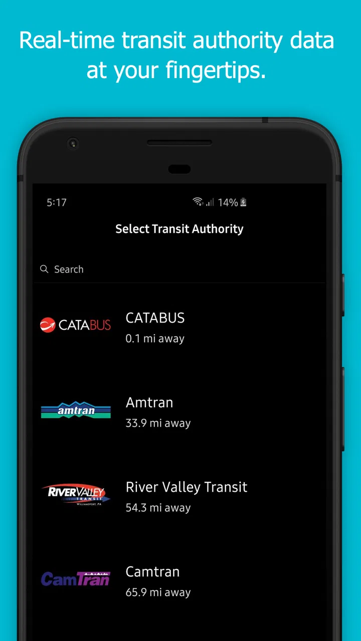
Look for the transit system or location that matches where you intend to travel, then narrow your attention to a route or stop. The exact choices available can depend on the supported network, so I would avoid treating the opening screen as a test of your own technical ability. If the app seems unhelpful before a provider or location is selected, that may simply mean it needs more context from you.
A useful setup habit is to save your mental “home base” rather than exploring randomly. That could be the stop near your home, workplace, campus, or hotel. Once you have found the place you actually use, the app becomes easier to judge. I find that many transit apps feel confusing only because a new user begins with a destination and expects the app to infer every relevant stop. Starting with a known stop gives you a cleaner first success.
Before depending on it for an important appointment, spend a few minutes checking whether the displayed information matches the service you recognize. Real-time information is valuable precisely because it can change, but that also means I would not treat one screen as a permanent promise. Transit conditions move, and a responsible rider still leaves room for delays, crowded vehicles, missed connections, or information that has not refreshed as expected.
The first meaningful action: checking a real stop
For me, the first successful action is not downloading the app or browsing a route. It is opening a familiar stop and using the information there to decide when to leave. That is the moment the app proves its purpose. If I normally walk to a stop and wait without knowing whether the next vehicle is close, a current arrival view can turn that vague wait into a more concrete decision.
Try this workflow: choose a stop you know, identify the direction you need, and compare the next service information with the usual timetable. If the result looks sensible, repeat the check later in the day rather than immediately switching to a complicated journey. This second check helps you understand how the app fits changing travel conditions and whether it is useful during the times you actually ride.
One non-obvious benefit of this approach is that it teaches you to separate route identity from direction. New riders often recognize a route number but overlook whether the vehicle is traveling toward the destination or away from it. When using myStop® Mobile, I make the direction part of my routine: I confirm the stop, the route, and the intended side of travel before acting on an arrival time. That small pause can prevent the frustrating mistake of boarding the correct route in the wrong direction.
Another practical use is checking before leaving a building rather than after reaching the stop. If the information suggests that the next service is not imminent, I can finish a task or leave a little later instead of standing outside for the entire interval. I would not stretch this into a guarantee that every delay will be predicted, but it is a sensible way to use real-time traveler information: as a decision aid, not as permission to arrive at the last possible second.
A realistic everyday scenario
Imagine I am leaving work on a rainy afternoon and need to catch a familiar bus. I open the app indoors, select the stop I normally use, and check the relevant direction. If the next vehicle is approaching, I put on my coat and leave promptly. If the wait is longer, I can finish packing my bag, refill my water bottle, or stay under cover for a little longer. Once I reach the stop, I check again rather than relying entirely on the first glance.
This scenario shows where the app earns its place on my phone. It is not necessarily helping me discover a restaurant, compare walking shortcuts, or combine several unrelated transport modes. It is helping me answer one everyday question with less guesswork: should I leave now? For regular riders, that modest improvement can be more useful than a visually impressive map filled with options they do not need.
Where first-time users may become confused
The biggest source of confusion is expecting the app to behave exactly like a general navigation service. A broad maps app usually begins with a destination and builds a trip around it. A transit information app may require me to think in terms of the network, stop, route, and direction first. That is not necessarily a flaw, but it does change the order of operations.
If you enter a destination and do not immediately see a complete door-to-door plan, try reversing the process. Identify the transit provider or nearby stop, then inspect the service serving that point. For a known commute, this is often faster anyway. For a new city, however, I would use a general mapping tool to understand the overall journey and keep myStop® Mobile for the transit-specific check when the supported network makes it useful.
Another point worth remembering is that “real-time” does not mean “every part of the journey is perfectly predictable.” A live arrival estimate can help with timing, but it does not remove the need to verify the direction, allow time to reach the stop, or prepare for a connection. I treat the information as changing guidance. When a trip matters, I check it close to departure and avoid building a schedule with no margin.
There is also a difference between information being available and information being easy to interpret. Route names, stop names, directions, and arrival entries can look similar when I am tired or in a hurry. My practical solution is to learn the exact stop name I use and save it mentally, along with the direction. If I am helping a family member use the app, I would write down that simple combination rather than telling them only the route number.
Using it alongside the usual alternatives
I would compare myStop® Mobile with three familiar alternatives, but not assume one must replace the others. Official transit websites and printed schedules remain useful for understanding the full structure of a network, including route maps and planned timetables. A general maps app is usually stronger when I need walking directions, a destination search, or a trip involving several travel modes. A transit operator’s own channel may be preferable when I need network-specific notices or service announcements.
The focused advantage here is the quick return to traveler information for a supported service. Once I know the stop I care about, I do not necessarily want to rebuild the entire journey every time. That can make a dedicated transit app feel calmer and more direct. The weakness is equally clear: if my trip depends on walking through an unfamiliar neighborhood, coordinating multiple modes, or comparing several destinations, I would reach for a broader tool first.
I also would not choose it solely because it is free. Free removes the financial risk of trying it, but usefulness depends on whether it fits the transit network and habits I have. Someone who drives most days and only occasionally rides may find a general maps app sufficient. Someone who catches the same service several times a week is more likely to benefit from having a focused place to check transit information.
Three habits that make the app more reliable in daily use
First, I check the stop before I start walking toward it. This avoids wasting time at the wrong location and gives me a chance to confirm the direction. It sounds basic, but it is more valuable than repeatedly refreshing a screen after I have already committed to the journey.
Second, I use a familiar route as a calibration exercise. Compare what the app shows with what normally happens, but do so across different parts of the day. That helps me understand whether the information is useful for my commute, an evening trip, or a weekend errand. I would not assume that a good result at one time automatically makes every journey equally predictable.
Third, I keep a backup plan for important appointments. I might note the scheduled service, identify another nearby stop, or carry enough time for a missed connection. This is not a criticism unique to myStop® Mobile; it is the sensible trade-off of relying on changing transit information. The app can reduce uncertainty, but it cannot control the vehicle, traffic, weather, or my own walking speed.
Who should use it, and who should skip it
I would recommend trying myStop® Mobile if you regularly use a supported public-transit network and want a simple way to check traveler information before or during a ride. It is particularly appealing for people who already know their usual stops but dislike guessing when to leave. It may also help a visitor who has identified the local transit system and wants a focused view of that service instead of a crowded all-purpose map.
I would skip it as my primary navigation app if I need worldwide route discovery, detailed walking guidance, cycling directions, driving navigation, or a single planner that combines many transport types. I would also be cautious about making it the only tool for a complicated cross-city journey with several transfers. In those cases, a general mapping service or official network resource can provide broader context, while this app may still be useful for checking a particular transit leg.
The age rating of Everyone makes it suitable for a broad audience, but suitability is not the same as simplicity in every situation. A child, older relative, or occasional rider may still need help identifying the correct stop and direction. I find that explaining the workflow in plain language—“find the stop, check the direction, then check the next service”—is more helpful than handing someone the phone and expecting the interface to explain the network by itself.
My final take after using it as a transit companion
MyStop® Mobile works best when I give it a specific job: help me make a better timing decision for public transportation. That job is smaller than full navigation, but it is also the reason the app can feel useful without becoming another oversized map. The free price makes experimentation easy, and the app’s long availability since July 17, 2015, along with its current version 4.31.5, suggests a product intended to remain a practical part of a transit routine.
I would begin with one familiar stop, confirm the correct direction, and use the next arrival information to decide when to leave. After that first success, I would test it on another trip and keep a broader navigation option available for unfamiliar routes. That approach is reassuring because it does not ask the app to solve every travel problem at once.
My recommendation is simple: choose myStop® Mobile when your priority is checking supported transit information with less waiting-room guesswork, but pair it with a broader map or official network source when the journey itself is complicated. For a regular rider, that focused role can be enough to justify keeping it installed. For someone seeking an all-purpose navigator, it is better viewed as a useful specialist than as a complete replacement.
FAQs for myStop® Mobile
01What is myStop® Mobile and what does it do?
myStop® Mobile is a transit app designed to provide real-time bus tracking and schedule updates. It allows users to view the exact location of buses, plan trips, receive alerts, and access route information. It's a convenient tool for anyone who regularly uses public transportation and wants to optimize their travel experience.
02Is myStop® Mobile available for both Android and iOS devices?
Yes, myStop® Mobile is available for both Android and iOS platforms. Users can download it from the Google Play Store for Android devices and the Apple App Store for iOS devices. The app is designed to offer a seamless experience across both operating systems with consistent features and updates.
03Does myStop® Mobile require an internet connection to function?
Yes, myStop® Mobile requires an active internet connection to provide real-time updates and accurate bus tracking information. While some features like saved schedules may be accessible offline, the core functionalities like live bus tracking and notifications rely on a stable internet connection to work effectively.
04Are there any costs associated with using myStop® Mobile?
myStop® Mobile is free to download and use. However, it may consume data depending on your mobile plan when accessing real-time updates and maps. There are no in-app purchases required to access its main features, making it a cost-effective solution for commuters.
05How accurate is the bus tracking and schedule information on myStop® Mobile?
The accuracy of bus tracking and schedule information in myStop® Mobile can vary based on the data provided by the local transit authorities. Generally, the app provides reliable real-time updates, but occasional discrepancies might occur due to traffic conditions or system updates. It's always a good idea to double-check with local sources during peak times.
Pros
- User-friendly interface enhances navigation.
- Real-time updates for accurate bus tracking.
- Customizable alerts for preferred routes.
- Supports multiple transit systems seamlessly.
- Low data usage
- ideal for limited plans.
Cons
- Limited offline functionality available.
- Sometimes experiences minor app lag.
- Occasional inaccuracies in schedule data.
- Interface lacks some advanced features.
- Requires location services for full use.

myStop® Mobile
Gallery